Mauritania was originally inhabited by the Bafour tribe. Between 200 and 600 AD, Berber tribes entered the country and became the dominant nation. The southern part of Mauritania remained under the possession of the Ghana Empire until the 11th century when the Muslim warrior monks defeated the Ghana Empire. Over the next 500 years, the Arabs conquered the Berbers and took full control of the territory.
In the early 30th century, the French invaded the area. This put an end to slavery and wars between clans. In 1960, Mauritania became an independent country. The capital Nouakchott was founded at this time. At that time, 90% of the population were still nomadic tribes. The first president was Moktar Ould Daddah.
| Capital | Nouakchott |
| Population | 4,885,998 (Source: 2023 worldometer) |
| Major Cities | Nouakchott (capital), Nouadhibou, Kaédi, Néma, Kiffa, Atar, Sélibaby, Zouérat, Rosso |
| Borders | Moroccan-occupied Western Sahara to the northwest, Algeria to the northeast, Mali to the east and southeast; the Senegal River forms the border with Senegal in the southwest |
| Gross Domestic Product (GDP) | $10,375,460,680 (2022 worldometer) |
| Currency | ouguiya (MRO) |
Mauritania Major Industries: fish processing, mining of iron ore and gypsum
Mauritania Agricultural Products: dates, millet, sorghum, rice, corn; cattle, sheep
Mauritania Natural Resources: iron ore, gypsum, copper, phosphate, diamonds, gold, oil, fish
Mauritania Major Exports: iron ore, fish and fish products, gold
Mauritania Major Imports: machinery and equipment, petroleum products, capital goods, foodstuffs, consumer goods
Total Size of Mauritania: 1,030,700 square kilometres (source: wikipedia)
Geographical Low Point of Mauritania: Sebkhet Te-n-Dghamcha -5 m
Geographical High Point of Mauritania: Kediet Ijill 915 m
Climate of Mauritania: desert; constantly hot, dry, dusty
General Terrain of Mauritania: mostly barren, flat plains of the Sahara Desert ; some central hills
World Region or Continent of Mauritania: Africa
Geographical Coordinates: 20 00 N, 12 00 W
Mauritania Government Type: republic
Mauritania Nationality: Mauritanian(s)
Mauritania National Holiday: Independence Day, 28 November (1960)
Mauritania Independence: 28 November 1960 (from France)
Mauritania National Symbol: star and crescent
Mauritania National Anthem or Song: Hymne National de la Republique Islamique de Mauritanie (National Anthem of the Islamic Republic of Mauritania)
Mauritania Languages Spoken: Arabic (official), Pulaar, Soninke, French, Hassaniya, Wolof
Mauritania Religions: Muslim 100%
The name Mauritania comes from the ancient kingdom of Mauretania, which is derived from the Mauri (meaning Moors), the Berber-speaking people of northwestern Africa.
Founded in the 3rd century, the UNESCO archaeological site of Volubilis in what is now Morocco is the capital of Mauritania and has many Roman city ruins built there.
The modern capital of Mauritania, Nouakchott, is probably derived from the Berber word “nawakshut” meaning “place of the wind”.
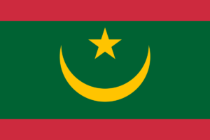
The flag of Mauritania has a green background with a crescent and star in the center and red bands above and below. The green, star, and crescent are traditional Muslim symbols, and red symbolizes the bloodshed in the struggle for independence from France.
After gaining self-rule in 1958, Mauritania gained full independence in 1960. Mauritania became the last country in the world to abolish slavery when the practice was finally banned in 1981. In 2012, an estimated 10-20% of the population still lived in slavery.
Mauritania includes part of the largest desert in the world. The Sahara Desert, with a total area of 8,600,000 square kilometers (3,320,000 sq mi), covers most of North Africa.
22.1% of Mauritania’s population lives in poverty. Malnutrition is still common: 9.8% of young children are acutely malnourished.
Auritania is home to the Richat Structure, sometimes called the “Eye of the Sahara” or the “Eye of Africa”. Seen from space, the circular geological feature is 45 km (28 mi) in diameter and is attributed to a raised dome that has eroded to reveal onion-like layers of rock.
The largest naval cemetery in the world is in Mauritania. Near the town of Nouadhibou, hundreds of shipwrecks have washed up in shallow water and been salvaged or abandoned. Mauritania is rich in mineral resources including iron ore, gold, copper, gypsum and phosphate rock.
Mauritania is also one of Africa’s newest oil producers after the discovery of the Chinguetti oil field in 2001, with potential reserves of about 120 million barrels of oil.
In 2019, one of the world’s largest natural gas discoveries was also discovered in the waters off Mauritania, with a potential of 50 trillion cubic feet of gas, or about 8.9 billion barrels of oil.
Mauritania has one of the longest trains in the world. The “Train du Ore de Fer” or “Train du Désert” line is usually 2.3 km long when connecting the Zouerat iron mines with Nouâdhibou.

