Kiribati is an island country in the Pacific Ocean. It was first settled by Kiribati around 1000 AD. The first Europeans arrived on the island in the 15th century, but it wasn’t until the 19th century that more Europeans started arriving. At that time, they brought disease and provoked regional conflicts. The British took control of the islands then called the Gilbert Islands in her 1892. It became an official British colony in 1916.
During World War II, Japan gained control of several islands. Some of the fiercest fighting in the South Pacific took place on the Tarawa Atoll when the United States fought Japan at the turning point of the war. Kiribati became a fully independent country in 1979. Kiribati’s first president was Yeremiah Tabai.
| Capital | Tarawa |
| Population | 133,906 (Source: 2023 worldometer) |
| Major Cities | Tarawa (capital), Betio Village, Bikenibeu Village, Teaoraereke Village, Bairiki Village, Eita Village, Bonriki Village |
| Borders | Pacific Ocean |
| Gross Domestic Product (GDP) | $223,352,943 (2022 worldometer) |
| Currency | Australian dollar (AUD) |
Kiribati Major Industries: fishing, handicrafts
Kiribati Agricultural Products: copra, taro, breadfruit, sweet potatoes, vegetables; fish
Kiribati Natural Resources: phosphate (production discontinued in 1979)
Kiribati Major Exports: copra 62%, coconuts, seaweed, fish
Kiribati Major Imports: foodstuffs, machinery and equipment, miscellaneous manufactured goods, fuel
Total Size of Kiribati: 811 km² (source: 2022 wikipedia)
Geographical Low Point of Kiribati: Pacific Ocean 0 m
Geographical High Point of Kiribati: unnamed location on Banaba 81 m
Climate of Kiribati: Tropical; marine, hot and humid, moderated by trade winds
General Terrain of Kiribati: mostly low-lying coral atolls surrounded by extensive reefs
World Region or Continent of Kiribati: Oceania
Geographical Coordinates: 1 25 N, 173 00 E
Kiribati Government Type: republic
Kiribati Nationality: I-Kiribati (singular and plural)
Kiribati National Holiday: Independence Day, 12 July (1979)
Kiribati Independence: 12 July 1979 (from UK)
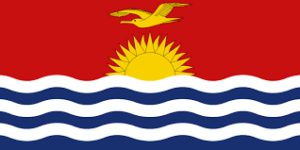
Kiribati National Symbol: frigatebird
Kiribati National Anthem or Song: Teirake kaini Kiribati (Stand Up, Kiribati)
Kiribati Languages Spoken: I-Kiribati, English (official)
Kiribati Religions: Roman Catholic 52%, Protestant (Congregational) 40%, some Seventh-Day Adventist, Muslim, Baha’i, Latter-day Saints, Church of God (1999)
The majority of Kiribati’s population is Christian. Freedom of religion is a fundamental right and this right is highly respected in this country.
Kiribati is one of the poorest countries in the world due to its lack of natural resources. The country supports its economy through tourism, which accounts for almost 20% of GDP.
Kiribati is the only country in the world located in all four hemispheres (north, south, east and west) of the world.
The New Year is celebrated first in Kiribati and then in other countries around the world. This is because currently the farthest country from Greenwich than Greenwich is Kiribati at GMT+14 hours.
Over 90% of the country’s population lives in the Gilbert Islands. And most of them live in Tarawa.
The country’s highest point is just 81 meters above sea level. In 1999, two small uninhabited islands disappeared into the sea due to rising sea levels.
Kiribati is made up of 33 coral islands, divided into her three groups: the Line Islands, the Phoenix Islands and the Gilbert Islands. Most of these islands are coral atolls. According to Britannica, “Atolls form when corals form colonies or reefs around the tip of a volcanic island.” Eventually the reef reaches the surface and becomes land.
Of Kiribati’s 33 islands, 21 are inhabited. Banaba Island in the Gilbert Islands is a raised limestone island, while the other 32 islands are all atolls. H. They are circular, with a lagoon in the middle.
Growing crops in this island nation is extremely difficult due to poor soils and variable rainfall. However, the island nation is rich in seafood.
Kiribati is prone to sea level rise due to global warming, and fresh water is polluted with salt water, making it unsuitable for drinking. After that, the island becomes uninhabitable. The country generates a large amount of solid waste, but unfortunately the country does not have a proper waste disposal system or waste management system to solve this problem.

